


.svg)



Start with the answer, because it is not complicated. Split the building into what can be reached safely and what cannot. Capture each part with the instrument suited to it: terrestrial laser scanning from the ground and drone LiDAR from the air. Then bring both datasets into a single coordinate system so the result behaves as one building rather than two surveys that happen to describe the same place.
The part that is easy to get wrong is the order. On a damaged heritage building, the survey plan is a safety plan first. Deciding where a person may stand comes before deciding where a scanner goes.
Why access, not geometry, is the real constraint
Most guidance on documenting historic buildings treats the difficulty as complexity: ornament, irregular geometry and centuries of alteration. That is real, and it is solvable with the right level of information and enough time.
On a building that has burned, partially collapsed or been left open to weather for years, the difficulty is different. The geometry may be simple. The problem is that nobody can safely get to it.
We have documented buildings where whole wings could not be entered, where the roof was the least stable part of the structure and also the part the restoration team most needed measured, and where façade sections were too high or too fragile to approach from the ground. In every one of those cases, the question was not “How precisely can we measure this?” It was “How do we measure this without putting anyone under it?”
That reframing changes the whole method. A survey plan for a sound building is primarily a coverage plan. A survey plan for a damaged one is a coverage plan constrained by a safety assessment, and the assessment comes first.
Four failure points to plan for
1. Treating the drone as a substitute rather than a complement
Aerial LiDAR solves the roof and other inaccessible exterior areas. It does not solve a vaulted interior, a stair core or the underside of a cornice. A drone-only capture can leave gaps that are discovered only after demobilisation, when returning means another mobilisation.
2. Planning the capture around the model instead of around the building
The instinct is to decide the deliverable first and then capture only what the model appears to need. On a damaged building this can be backwards. The building may reveal conditions the brief never anticipated, and a scan that captured only what was expected cannot answer the question that appears in month four.
3. Underestimating the join
Two datasets from two instruments are not automatically one dataset. Bringing terrestrial and aerial data into one coordinate system with controlled residuals is a real technical step, and it is the step that decides whether the result can be trusted.
4. Recording geometry but not condition
A point cloud shows where surfaces are. It does not, on its own, classify a structural crack, distinguish superficial fire damage from deeper material loss or explain which element has moved. Condition and damage documentation are separate tasks with a separate purpose, and conservation teams often need that information as much as they need the geometry.
The method, step by step
1. Exterior safety assessment, before anything is unpacked. Walk the perimeter. Establish which elevations can be worked beneath, which cannot and which parts of the interior are enterable at all. The output is a simple map of reachable and unreachable areas. Every later decision follows from it.
2. Aerial LiDAR for the unreachable. Use it for roof structures, upper façades, collapsed sections and overhead areas that a person should not stand beneath. LiDAR is often preferable where poor lighting, low-texture surfaces, vegetation or difficult viewing geometry make image-based reconstruction less reliable.
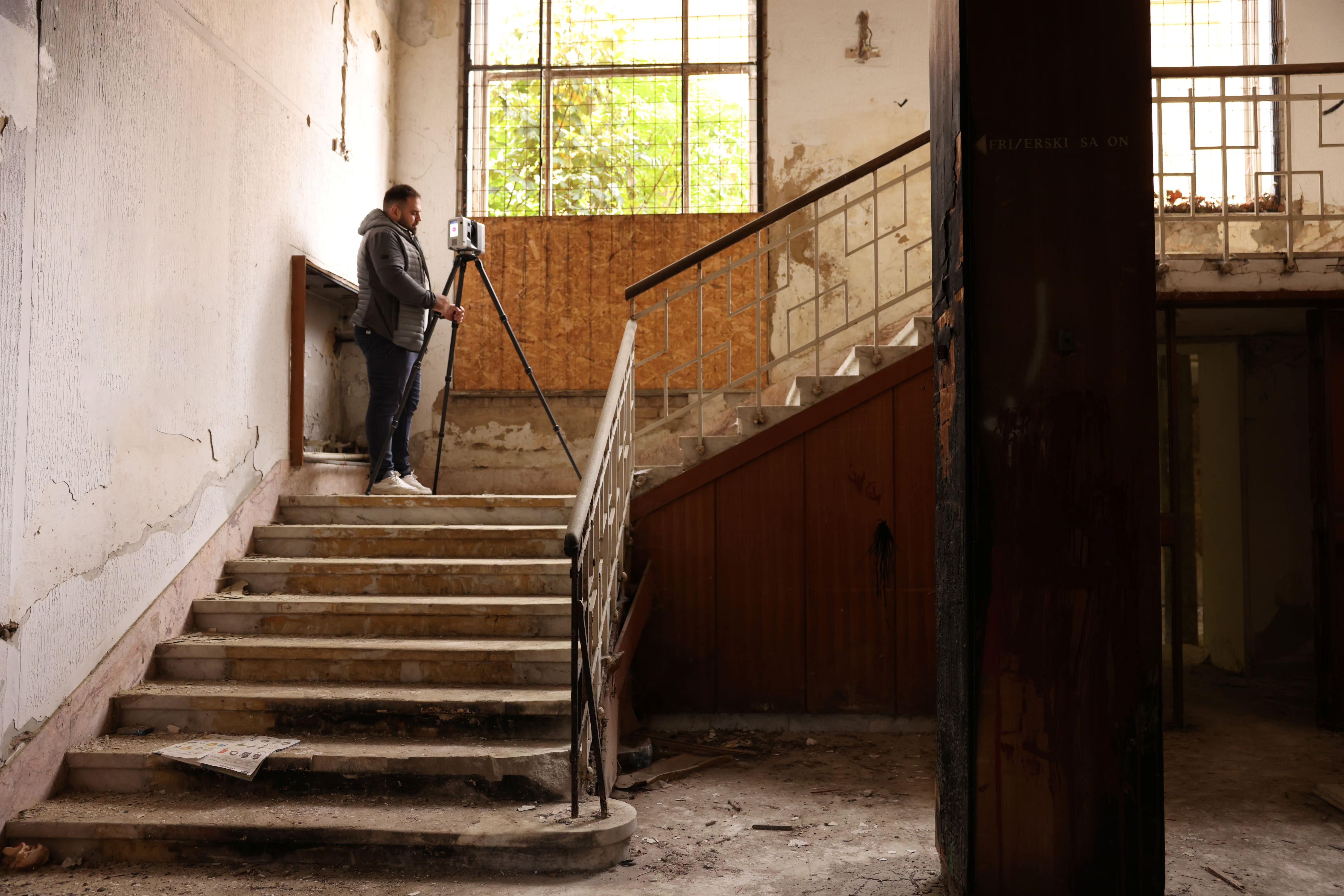
3. Terrestrial scanning for everything that can be reached safely. Interiors, ground-level façades, courtyards and any wing assessed as enterable can be recorded at higher point density and from positions close to the detail that matters.
4. Hybrid alignment. Bring the aerial and terrestrial data into one coordinate system. This is the technical heart of the job.
5. Damage documentation. Make a dedicated pass across all observable surfaces, recording condition rather than only position: structural movement, fire damage, water ingress, missing elements and material loss.
6. Heritage detail capture. Raise the level of detail deliberately for ornament, profiles, mouldings and any geometry that may have to be reproduced during restoration.
7. Deliverables to the design team. Provide the measured record in forms the project can use: point cloud, HBIM, 2D drawings, condition documentation and visual material for stakeholders who will never open a model.
Steps 1 and 5 are the two most easily compressed when a schedule tightens. They are also the two a restoration architect is most likely to miss when they are absent.
How the two datasets are actually joined
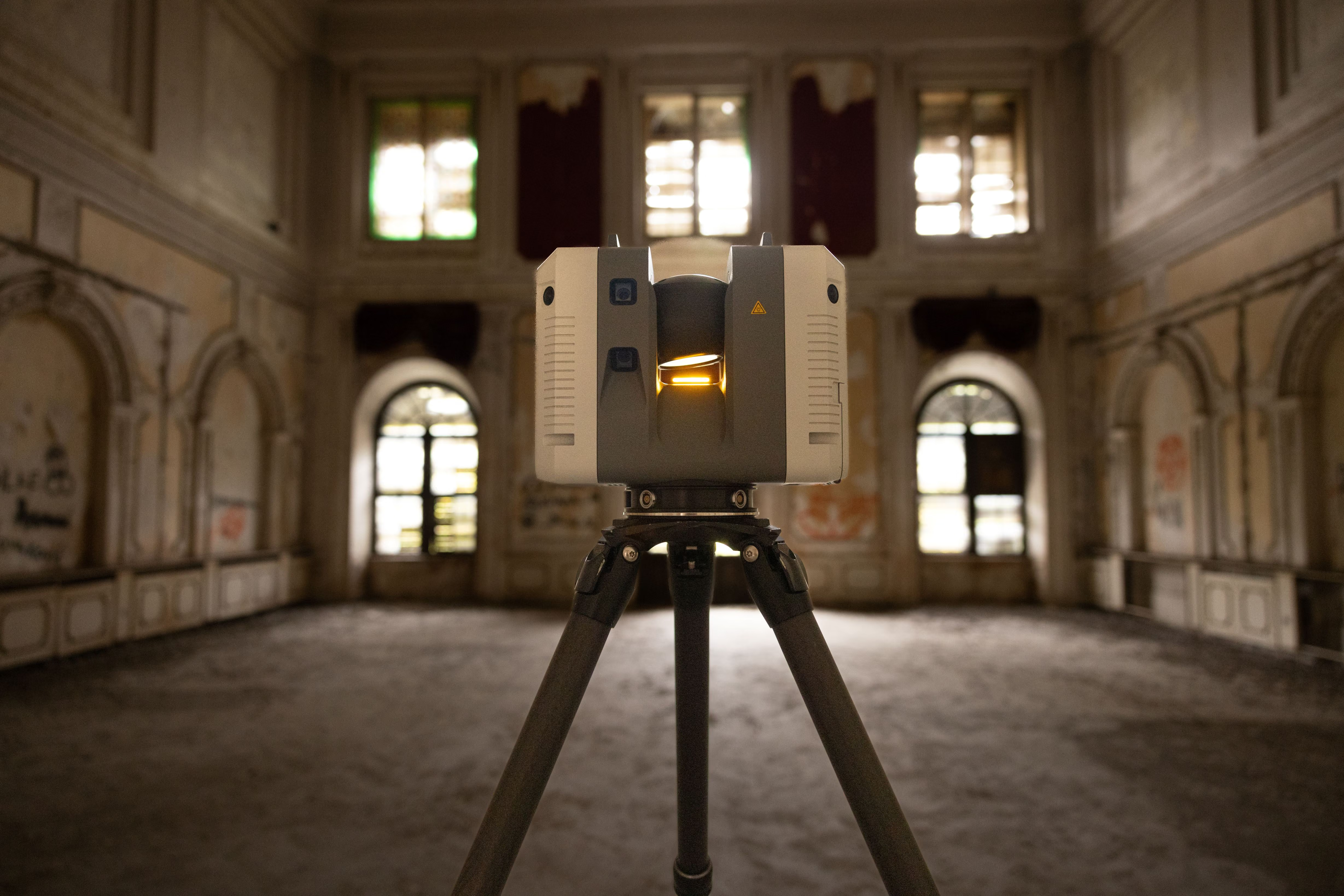
Registration is the process of bringing separate scans into one coordinate system so that a wall measured from inside and the same wall measured from above end up in the same place. Within a single instrument workflow it is routine. Across a terrestrial scanner and an airborne LiDAR sensor it needs planning.
Three things make the join work:
· Overlap that was planned, not hoped for.
· Surfaces that are visible from both air and ground.
· Geodetic control tying both datasets to one reference frame.
The last one is often underestimated, and it is why we treat geodesy as the start of the process rather than a formality at the end. Without a reliable control framework, two clouds can be aligned to look correct and still contain relative error that becomes visible only when drawings or models are produced.
The practical test is not whether the merged cloud looks right on screen. It is whether the residuals are documented and whether someone other than the person who performed the registration has checked the result. On our projects, a registered cloud is reviewed by a team member who did not carry out that registration. It takes time, but it catches problems.

What it costs in time, and what it costs to skip
Damaged buildings take longer per square metre than sound ones, and the extra time is not mainly spent scanning. It goes into access planning, split capture, hybrid registration, condition recording, heritage detail and quality control.
For comparison, on a protected Belgrade façade in sound condition we scanned approximately 2,500 m² in one day and delivered the model in ten working days. A damaged building of the same area does not fit the same production curve. Quoting it as though it does is how projects go wrong for both sides.
The cost of skipping the work is asymmetric. A survey that misses a burned wing may not be repeatable once scaffolding is installed, demolition begins or a fragile section deteriorates further. A building in this condition is continuously losing information. What is not recorded now may not be recordable later.
You cannot restore what you cannot measure.
A worked example: Staro Zdanje, Aranđelovac
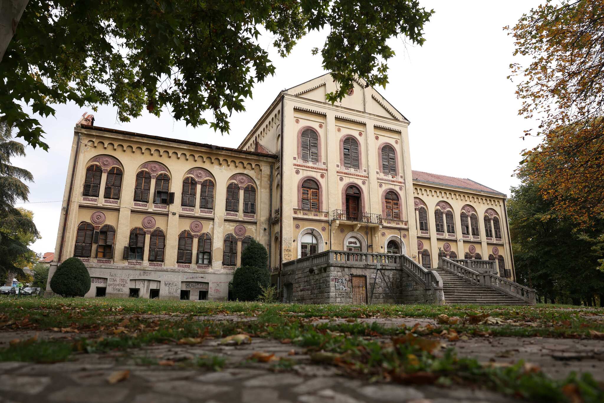
Staro Zdanje stands in the park at Bukovička Banja. Construction began in 1868 on the initiative of Prince Mihailo Obrenović, to a design by the Munich-trained architect Kosta Šrepović, and the building covers around 9,000 m². It was conceived as a possible seat of the Serbian Assembly, later became a summer residence of the Obrenović family and, after the narrow-gauge railway reached Aranđelovac in 1906, operated as a hotel for much of the following century.
On 22 March 2022, a fire destroyed the roof and severely affected the right wing.
When we arrived, the building presented every constraint in this article at once. Part of the roof was gone. Several interior areas were unsafe to enter. Whole façade sections could not be approached from the ground. The structure had shifted, decorative elements had weathered, and the roof - the part in the worst condition - was exactly what the restoration team needed measured most. Four of us worked three days on site.
The capture split followed the safety assessment. A DJI Matrice 350 RTK carrying a Zenmuse L2 LiDAR sensor covered the burned roof and elevations that could not be safely approached. A Leica RTC360 and a BLK360 G2 covered the accessible interior wings and ground-level areas. Registration was completed in Leica Cyclone REGISTER 360 PLUS, modelling in Autodesk Revit and visualisation in Nubigon.
The result was a single registered point cloud of the building, an HBIM delivered to the architects, condition and damage documentation across observable surfaces, and visual material that people outside the design team could understand. Lidar News, which covered the project independently, reported millimetre-level alignment between the aerial and terrestrial data.
The important part is not the equipment list. It is that the sequence held: the safety assessment decided the capture plan, the capture plan decided the instruments, and the building was documented in the condition it was actually in rather than the condition anyone assumed it to be in.
What the client actually receives
Point cloud
The measured record. Everything else is derived from it, and it remains the reference when a question appears two years later.
HBIM model
Usable geometry for design, created at a level of information need agreed for the project rather than at the maximum level the scanner can capture.
2D drawings
Plans, sections and elevations for people and approval processes that still work in two dimensions, including many heritage review routes.
Damage documentation
Condition recorded against location. For a conservation architect, this is often one of the first deliverables to be reviewed.
Visual material
Renders and walkthroughs for owners, funders and committees who will never open a point cloud or HBIM model but may decide whether the project moves forward.
A model that cannot be used is only a good-looking file. On a heritage project, the test is whether the restoration team can make decisions from the documentation without coming back with questions the survey should already have answered.
Questions we are asked most
Can you document a building that is completely unsafe to enter?
Usually yes, although the result is different. Aerial LiDAR and external terrestrial scanning can produce a complete exterior record and often partial interior coverage through openings. Anything that cannot be captured should be stated clearly rather than modelled from assumption.
Drone photogrammetry or drone LiDAR?
LiDAR is often preferable where geometry is the priority and conditions include low texture, poor lighting, vegetation, complex visibility or fire-damaged surfaces. Photogrammetry is valuable where colour and surface appearance carry important information. On many heritage projects the two methods are complementary rather than mutually exclusive.
How is this different from scanning an ordinary building?
The biggest differences are the safety assessment before the survey plan, the split capture across accessible and inaccessible areas, the hybrid registration workflow and the dedicated condition documentation.
What level of detail should a heritage model have?
The level the project needs, not the maximum available. We prefer to define the information required for the decisions ahead and raise detail only where it matters: ornament, profiles, interfaces and elements that may need to be reproduced.
When should documentation happen relative to design?
Before it. Design decisions made on assumed geometry are often revised once measured geometry arrives, and on a protected building those revisions can be expensive because the range of acceptable interventions is constrained.
Talk to us before the restoration plan becomes a survey problem
If access is the reason your project has not yet been documented, send us photographs, existing drawings or the site location. We can assess which parts are realistically reachable from the ground, which require aerial LiDAR and what level of documentation is achievable before mobilisation.
Radin AG works on heritage and protected buildings across Europe.
Contact: www.radin3d.com/contact
.jpg)
.webp)

